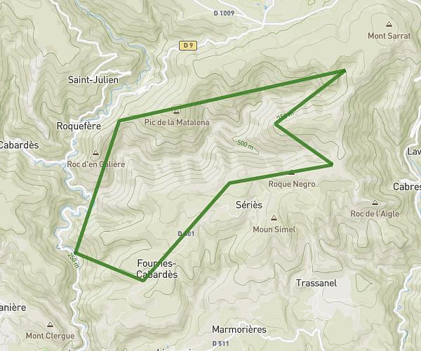
This hiking trail covers 3.619mi starting from Mas-Cabardès, Aude. The hike is a loop trail and returns to the trailhead. This hike is rated as hard, plan for about 2h to complete it. The route has an elevation gain of 1001ft and an elevation loss of 1004ft.
Mas Cabardes
Route details
1.81mph
Speed
913 kcal
Calories burned
10.5%
Avg grade
Loop trail
Route type
1017ft
Min altitude
1886ft
Max altitude
Steep climb
Route profile
1001ft
Elevation gain
1004ft
Elevation loss
1017ft
Min altitude
1886ft
Max altitude
How to get there
Trailhead: Rue Des Broutières, 11380 Mas-Cabardès, France
GPS coordinates of the trailhead: 43.36835, 2.36746 / 43°22'6'' N, 2°22'2'' E