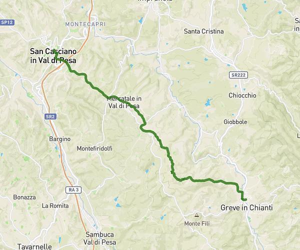
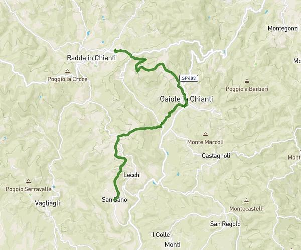
This hiking trail covers 13.049mi starting from Greve in Chianti, Florence. The hike does not return to the trailhead and ends near Via Aldo Moro 5a, 53017 Radda in Chianti Siena, Italy. This hike is rated as moderate, plan for about 8h49m to complete it. The route has an elevation gain of 2425ft and an elevation loss of 1617ft.
Greve in Chianti - Radda in Chianti
Route details
1.48mph
Speed
3920 kcal
Calories burned
5.9%
Avg grade
Point to point
Route type
768ft
Min altitude
2172ft
Max altitude
Route profile
2425ft
Elevation gain
1617ft
Elevation loss
768ft
Min altitude
2172ft
Max altitude
How to get there
Trailhead: Via Cesare Battisti 1, 50022 Greve in Chianti Florence, Italy
GPS coordinates of the trailhead: 43.58286, 11.31714 / 43°34'58'' N, 11°19'1'' E