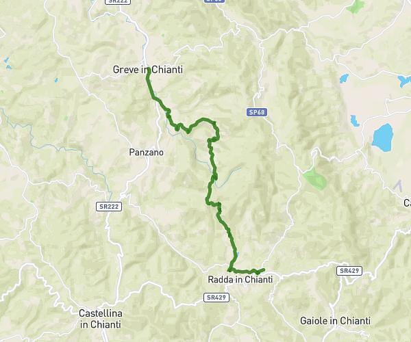
This hiking trail covers 10.563mi starting from San Casciano in Val di Pesa, Florence. The hike does not return to the trailhead and ends near Via Giacomo Brodolini 5, 50022 Greve in Chianti Florence, Italy. This hike is rated as hard, plan for about 4h15m to complete it. The route has an elevation gain of 1106ft and an elevation loss of 1342ft.
San Casciano in Val di Pesa - Greve in Chianti
Route details
2.49mph
Speed
1844 kcal
Calories burned
4.4%
Avg grade
Point to point
Route type
728ft
Min altitude
1460ft
Max altitude
Route profile
1106ft
Elevation gain
1342ft
Elevation loss
728ft
Min altitude
1460ft
Max altitude
How to get there
Trailhead: Via Montopolo 15, 50026 San Casciano in Val di Pesa Florence, Italy
GPS coordinates of the trailhead: 43.65983, 11.18635 / 43°39'35'' N, 11°11'10'' E