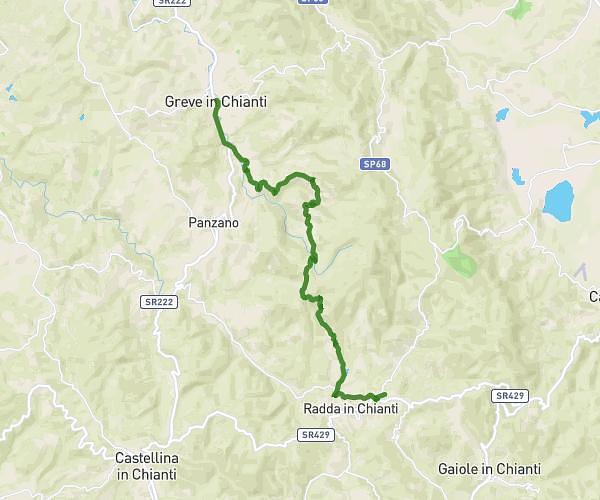
This hiking trail covers 9.995mi starting from Radda in Chianti, Siena. The hike does not return to the trailhead and ends near Viale Della Liberta' 26, 53013 Gaiole in Chianti Siena, Italy. This hike is rated as strenuous, plan for about 5h26m to complete it. The route has an elevation gain of 1657ft and an elevation loss of 1978ft.
Radda (Villa) - San Sano
Route details
1.84mph
Speed
2401 kcal
Calories burned
6.9%
Avg grade
Point to point
Route type
1112ft
Min altitude
1906ft
Max altitude
Route profile
1657ft
Elevation gain
1978ft
Elevation loss
1112ft
Min altitude
1906ft
Max altitude
How to get there
Trailhead: Via Giorgio La Pira 16, 53017 Radda in Chianti Siena, Italy
GPS coordinates of the trailhead: 43.49073, 11.38963 / 43°29'26'' N, 11°23'22'' E