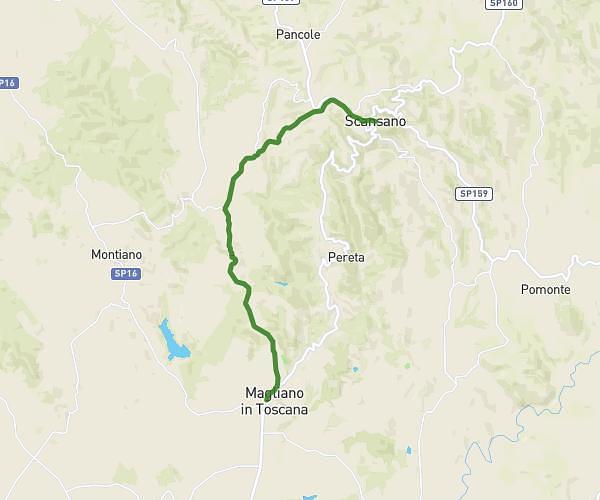
This hiking trail covers 16.092mi starting from Magliano in Toscana, Grosseto. The hike does not return to the trailhead and ends near Via Della Marina 33, 58015 Orbetello Grosseto, Italy. This hike is rated as hard, plan for about 7h23m to complete it. The route has an elevation gain of 991ft and an elevation loss of 1398ft.
Montiano > Tlamone
Route details
2.18mph
Speed
3162 kcal
Calories burned
2.8%
Avg grade
Point to point
Route type
-7ft
Min altitude
663ft
Max altitude
Route profile
991ft
Elevation gain
1398ft
Elevation loss
-7ft
Min altitude
663ft
Max altitude
How to get there
Trailhead: Strada Provinciale 16 Di Montiano, 58051 Magliano in Toscana Grosseto, Italy
GPS coordinates of the trailhead: 42.6793, 11.18439 / 42°40'45'' N, 11°11'3'' E