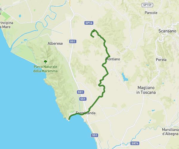
This hiking trail covers 10.05mi starting from Scansano, Grosseto. The hike does not return to the trailhead and ends near Strada Provinciale 160 Amiatina 8, 58051 Magliano in Toscana Grosseto, Italy. This hike is rated as hard, plan for about 4h8m to complete it. The route has an elevation gain of 656ft and an elevation loss of 1975ft.
Scansano-Magliano in Toscana
Route details
2.43mph
Speed
1772 kcal
Calories burned
5.0%
Avg grade
Point to point
Route type
266ft
Min altitude
1837ft
Max altitude
Route profile
656ft
Elevation gain
1975ft
Elevation loss
266ft
Min altitude
1837ft
Max altitude
How to get there
Trailhead: Piazza Giuseppe Garibaldi, 58054 Scansano Grosseto, Italy
GPS coordinates of the trailhead: 42.68816, 11.33526 / 42°41'17'' N, 11°20'6'' E