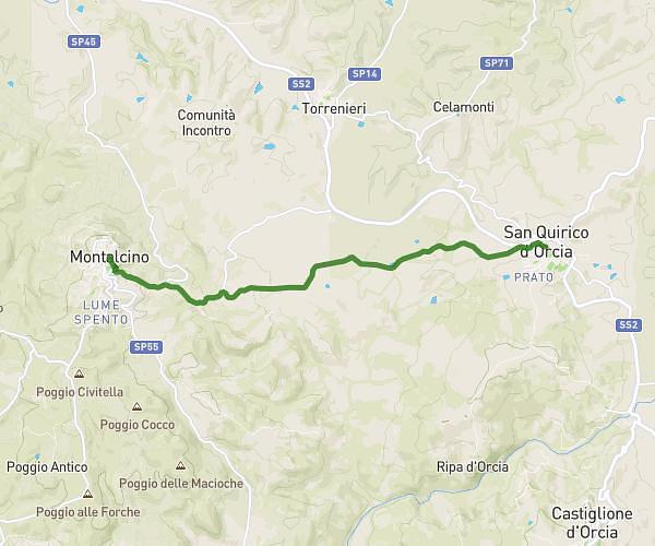
This hiking trail covers 8.1mi starting from San Quirico d'Orcia, Siena. The hike does not return to the trailhead and ends near Via Donnoli 16, 53024 Montalcino Siena, Italy. This hike is rated as moderate, plan for about 3h11m to complete it. The route has an elevation gain of 1447ft and an elevation loss of 961ft.
San Quirico Val d’Orcia > Montalcino
Route details
2.54mph
Speed
1412 kcal
Calories burned
5.6%
Avg grade
Point to point
Route type
761ft
Min altitude
1752ft
Max altitude
Route profile
1447ft
Elevation gain
961ft
Elevation loss
761ft
Min altitude
1752ft
Max altitude
How to get there
Trailhead: Via Fonte Alla Vena, 53027 San Quirico d'Orcia Siena, Italy
GPS coordinates of the trailhead: 43.05615, 11.60946 / 43°3'22'' N, 11°36'34'' E