MapPlanner
4.66mi
Distance
49m59s
Duration
8:35/mi
Pace
Easy
Level

Canicross 1

Route details

6.99mph
Speed
571 kcal
Calories burned
Loop trail
Route type
7ft
Min altitude
95ft
Max altitude

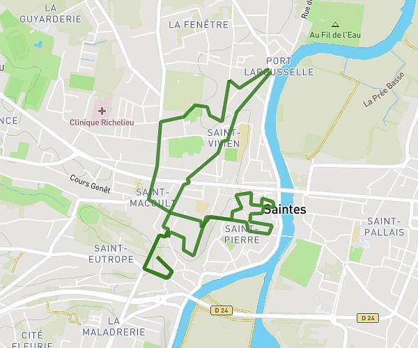
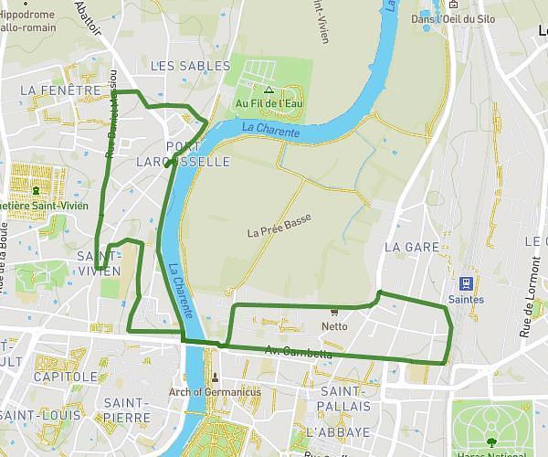
This running route covers 4.66mi starting from Saintes, Charente-Maritime. The run is a loop trail and returns to the trailhead. This run is rated as easy, expect about 49m59s to complete it. The route has an elevation gain of 187ft and an elevation loss of 187ft.

Description of the route by the creator

First canicross ride with Uzo

(Description automatically translated)

Route profile

187ft
Elevation gain
187ft
Elevation loss
7ft
Min altitude
95ft
Max altitude

How to get there

Trailhead: 52 Rue Georges Desclaude, 17100 Saintes, France

GPS coordinates of the trailhead: 45.75486, -0.64207 / 45°45'17'' N, 0°38'31'' W

Caution: May Cross Private Property

This route may pass through or near private property. Always respect posted signs, obtain permission where required, and follow local trespassing laws. MapPlanner does not guarantee public access along any route.

Safety Notice

Trail and road conditions may change without notice due to weather, construction, or other factors. Always verify current conditions before heading out. You are responsible for your own safety — follow local signage, obey traffic laws, and use your best judgment on the trail.