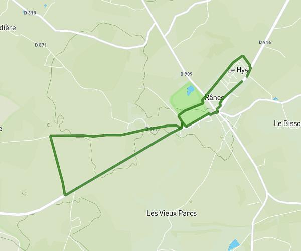
This running route covers 2.64mi starting from Saint-Denis-sur-Sarthon, Orne. The run is a loop trail and returns to the trailhead. This run is rated as easy, expect about 25m to complete it. The route has an elevation gain of 177ft and an elevation loss of 177ft.
run tranquille
Route details
6.34mph
Speed
286 kcal
Calories burned
Loop trail
Route type
610ft
Min altitude
686ft
Max altitude
Route profile
177ft
Elevation gain
177ft
Elevation loss
610ft
Min altitude
686ft
Max altitude
How to get there
Trailhead: Route Nationale, 61420 Saint-Denis-sur-Sarthon
GPS coordinates of the trailhead: 48.45674, -0.05247 / 48°27'24'' N, 0°3'8'' W