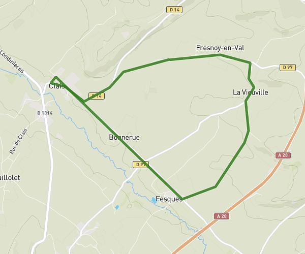
This running route covers 7.463mi starting from Mesnières-en-Bray, Seine-Maritime. The run is a loop trail and returns to the trailhead. This run is rated as hard, expect about 1h10m to complete it. The route has an elevation gain of 440ft and an elevation loss of 469ft.
Mesniere
Route details
6.32mph
Speed
810 kcal
Calories burned
Loop trail
Route type
161ft
Min altitude
630ft
Max altitude
Route profile
440ft
Elevation gain
469ft
Elevation loss
161ft
Min altitude
630ft
Max altitude
How to get there
Trailhead: 29 Place De La Mairie, 76270 Mesnières-en-Bray, France
GPS coordinates of the trailhead: 49.761424, 1.382121 / 49°45'41'' N, 1°22'55'' E