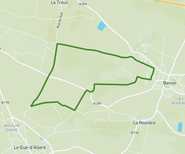
This running route covers 1.375mi starting from Benet, Vendée. The run is a loop trail and returns to the trailhead. This run is rated as easy, expect about 15m to complete it. The route has an elevation gain of 95ft and an elevation loss of 66ft.
Maison/rue la combe/les hauts de plaisance
Route details
5.5mph
Speed
172 kcal
Calories burned
Loop trail
Route type
59ft
Min altitude
154ft
Max altitude
Route profile
95ft
Elevation gain
66ft
Elevation loss
59ft
Min altitude
154ft
Max altitude
How to get there
Trailhead: 5 Rue Des Pisporettes, 85490 Benet, France
GPS coordinates of the trailhead: 46.36461, -0.60393 / 46°21'52'' N, 0°36'14'' W