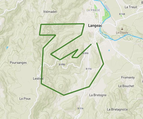
This running route covers 9.808mi starting from Langeac, Haute-Loire. The run is a loop trail and returns to the trailhead. This run is rated as hard, expect about 1h35m to complete it. The route has an elevation gain of 2208ft and an elevation loss of 2208ft.
Trail Langeac
Route details
6.2mph
Speed
1086 kcal
Calories burned
Loop trail
Route type
1713ft
Min altitude
2720ft
Max altitude
Route profile
2208ft
Elevation gain
2208ft
Elevation loss
1713ft
Min altitude
2720ft
Max altitude
How to get there
Trailhead: D 590, 43300 Langeac
GPS coordinates of the trailhead: 45.0909, 3.49124 / 45°5'27'' N, 3°29'28'' E