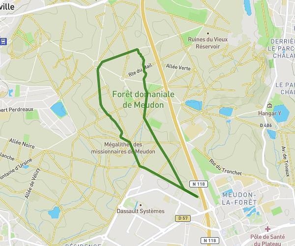
This running route covers 4.685mi starting from Élancourt, Yvelines. The run is a loop trail and returns to the trailhead. This run is rated as easy, expect about 55m to complete it. The route has an elevation gain of 381ft and an elevation loss of 374ft.
Le tour
Route details
5.11mph
Speed
629 kcal
Calories burned
Loop trail
Route type
390ft
Min altitude
587ft
Max altitude
Route profile
381ft
Elevation gain
374ft
Elevation loss
390ft
Min altitude
587ft
Max altitude
How to get there
Trailhead: 2 Villa Emmanuel Fremiet, 78990 Élancourt, France
GPS coordinates of the trailhead: 48.771692, 1.954138 / 48°46'18'' N, 1°57'14'' E