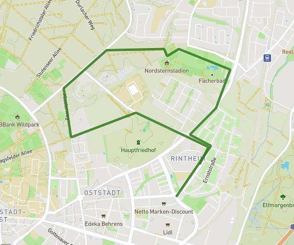
This running route covers 3.947mi starting from Karlsruhe, Baden-Württemberg. The run is a loop trail and returns to the trailhead. This run is rated as easy, expect about 40m to complete it. The route has an elevation gain of 20ft and an elevation loss of 16ft.
Abendlauf - Alb / Klotze
Route details
5.92mph
Speed
457 kcal
Calories burned
Loop trail
Route type
371ft
Min altitude
390ft
Max altitude
Route profile
20ft
Elevation gain
16ft
Elevation loss
371ft
Min altitude
390ft
Max altitude
How to get there
Trailhead: Lessingstraße 66, 76135 Karlsruhe, Germany
GPS coordinates of the trailhead: 49.006532, 8.384441 / 49°0'23'' N, 8°23'3'' E