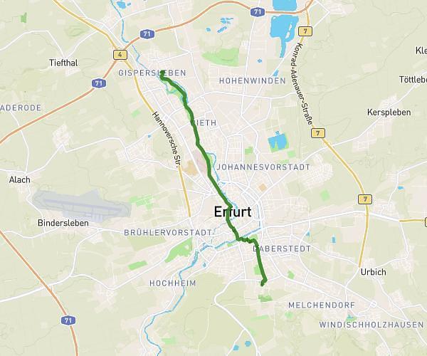
This cycling route covers 6.398mi starting from Erfurt, Thuringia. The ride does not return to the trailhead and ends near Constantin-Beyer-Weg 4, 99094 Erfurt, Germany. This route is rated as moderate, plan for about 39m to complete it. The route has an elevation gain of 161ft and an elevation loss of 459ft.
EGA
Route details
343 kcal
Calories burned
1.8%
Avg grade
Point to point
Route type
712ft
Min altitude
1033ft
Max altitude
Route profile
161ft
Elevation gain
459ft
Elevation loss
712ft
Min altitude
1033ft
Max altitude
How to get there
Trailhead: Auf Der Bärenburg 5, 99090 Erfurt, Germany
GPS coordinates of the trailhead: 51.001511, 10.946288 / 51°0'5'' N, 10°56'46'' E