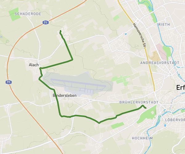
This cycling route covers 5.753mi starting from Erfurt, Thuringia. The ride does not return to the trailhead and ends near Am Flüßchen 9, 99091 Erfurt, Germany. This route is rated as easy, plan for about 29m14s to complete it. The route has an elevation gain of 230ft and an elevation loss of 449ft.
Schule
Route details
258 kcal
Calories burned
2.2%
Avg grade
Point to point
Route type
564ft
Min altitude
787ft
Max altitude
Route profile
230ft
Elevation gain
449ft
Elevation loss
564ft
Min altitude
787ft
Max altitude
How to get there
Trailhead: Jaraczewskystraße 1, 99096 Erfurt, Germany
GPS coordinates of the trailhead: 50.956177, 11.042701 / 50°57'22'' N, 11°2'33'' E