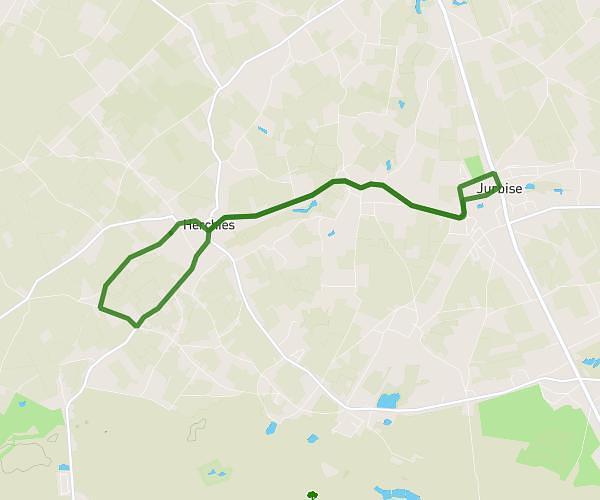
This running route covers 4.424mi starting from La Louvière, Hainaut. The run is a loop trail and returns to the trailhead. This run is rated as easy, expect about 47m to complete it. The route has an elevation gain of 52ft and an elevation loss of 62ft.
Course
Route details
5.65mph
Speed
537 kcal
Calories burned
Loop trail
Route type
367ft
Min altitude
423ft
Max altitude
Route profile
52ft
Elevation gain
62ft
Elevation loss
367ft
Min altitude
423ft
Max altitude
How to get there
Trailhead: Rue De L'yser 119, 7100 La Louvière, Hainaut, Belgium
GPS coordinates of the trailhead: 50.509881, 4.190221 / 50°30'35'' N, 4°11'24'' E