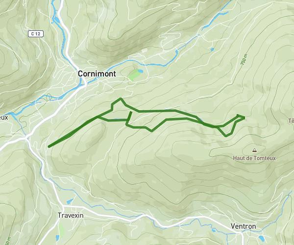
This running route covers 8.985mi starting from Storckensohn, Haut-Rhin. The run is a loop trail and returns to the trailhead. This run is rated as hard, expect about 2h24m to complete it. The route has an elevation gain of 3028ft and an elevation loss of 3028ft.
gite - gazon rouge 15k 923m
Route details
3.73mph
Speed
1653 kcal
Calories burned
Loop trail
Route type
1841ft
Min altitude
3980ft
Max altitude
Route profile
3028ft
Elevation gain
3028ft
Elevation loss
1841ft
Min altitude
3980ft
Max altitude
How to get there
Trailhead: 1a Chemin De La Kuttelmatt, 68470 Storckensohn, France
GPS coordinates of the trailhead: 47.87045, 6.94832 / 47°52'13'' N, 6°56'53'' E