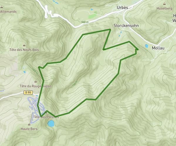
This running route covers 5.082mi starting from Cornimont, Vosges. The run is a loop trail and returns to the trailhead. This run is rated as moderate, expect about 55m to complete it. The route has an elevation gain of 1581ft and an elevation loss of 1578ft.
Vosges
Route details
5.54mph
Speed
629 kcal
Calories burned
Loop trail
Route type
1932ft
Min altitude
3081ft
Max altitude
Route profile
1581ft
Elevation gain
1578ft
Elevation loss
1932ft
Min altitude
3081ft
Max altitude
How to get there
Trailhead: 2 Chemin De La Lansaubure, 88310 Cornimont, France
GPS coordinates of the trailhead: 47.953167, 6.829221 / 47°57'11'' N, 6°49'45'' E