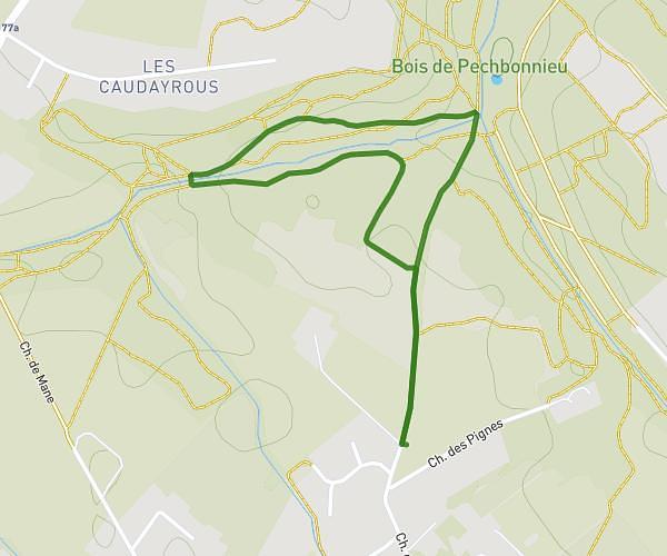
This walking route covers 3.683mi starting from Coufouleux, Tarn. The walk is a loop trail and returns to the trailhead. This walk is rated as moderate, plan for about 1h28m to complete it. The route has an elevation gain of 177ft and an elevation loss of 177ft.
Balade 40 min
Route details
24:08/mi
Pace
363 kcal
Calories burned
Loop trail
Route type
377ft
Min altitude
440ft
Max altitude
Route profile
177ft
Elevation gain
177ft
Elevation loss
377ft
Min altitude
440ft
Max altitude
How to get there
Trailhead: 145 Chemin De Palmato, 81800 Coufouleux, France
GPS coordinates of the trailhead: 43.79661, 1.739754 / 43°47'47'' N, 1°44'23'' E