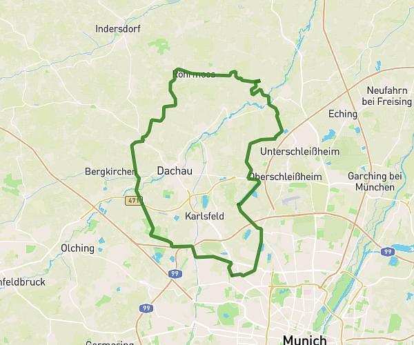
This cycling route covers 47.052mi starting from München, Bavaria. The ride is a loop trail and returns to the trailhead. This route is rated as strenuous, plan for about 2h13m to complete it. The route has an elevation gain of 886ft and an elevation loss of 886ft.
75k München Nord
Route details
1171 kcal
Calories burned
0.7%
Avg grade
Loop trail
Route type
1512ft
Min altitude
1821ft
Max altitude
Route profile
886ft
Elevation gain
886ft
Elevation loss
1512ft
Min altitude
1821ft
Max altitude
How to get there
Trailhead: Donauwörther Straße 41, 80997 München, Germany
GPS coordinates of the trailhead: 48.18398, 11.49731 / 48°11'2'' N, 11°29'50'' E