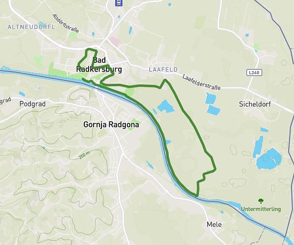
This running route covers 5.713mi starting from Bad Radkersburg, Styria. The run is a loop trail and returns to the trailhead. This run is rated as moderate, expect about 1h1m to complete it. The route has an elevation gain of 282ft and an elevation loss of 285ft.
RaJu 5-Kampf Update
Route details
5.62mph
Speed
697 kcal
Calories burned
Loop trail
Route type
669ft
Min altitude
719ft
Max altitude
Route profile
282ft
Elevation gain
285ft
Elevation loss
669ft
Min altitude
719ft
Max altitude
How to get there
Trailhead: Alfred Merlini-Allee 1, 8490 Bad Radkersburg, Austria
GPS coordinates of the trailhead: 46.685154, 15.984159 / 46°41'6'' N, 15°59'2'' E