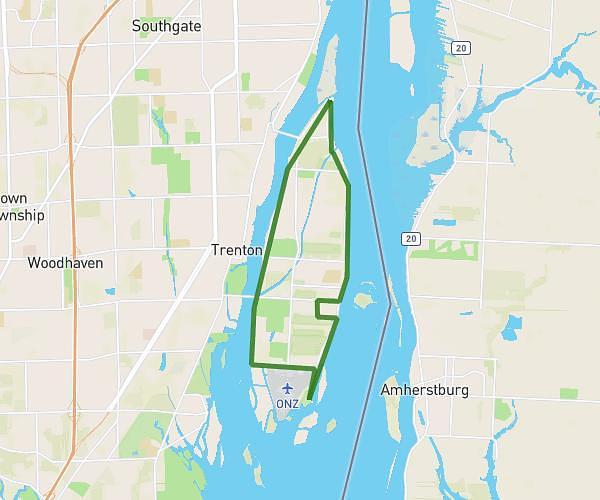
This cycling route covers 10.76mi starting from Sterling Heights, Michigan. The ride is a loop trail and returns to the trailhead. This route is rated as easy, plan for about 1h5m to complete it. The route has an elevation gain of 26ft and an elevation loss of 26ft.
Subdivision 1
Route details
569 kcal
Calories burned
0.1%
Avg grade
Loop trail
Route type
640ft
Min altitude
656ft
Max altitude
Route profile
26ft
Elevation gain
26ft
Elevation loss
640ft
Min altitude
656ft
Max altitude
How to get there
Trailhead: 43550 Perignon Drive, Sterling Heights, Michigan 48314, United States
GPS coordinates of the trailhead: 42.61257, -83.06944 / 42°36'45'' N, 83°4'9'' W