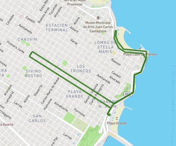
This running route covers 5.775mi starting from Mar del Plata, Buenos Aires Province. The run is a loop trail and returns to the trailhead. This run is rated as moderate, expect about 58m to complete it. The route has an elevation gain of 1106ft and an elevation loss of 1109ft.
2nd run
Route details
5.97mph
Speed
663 kcal
Calories burned
Loop trail
Route type
3ft
Min altitude
174ft
Max altitude
Route profile
1106ft
Elevation gain
1109ft
Elevation loss
3ft
Min altitude
174ft
Max altitude
How to get there
Trailhead: Primera Junta 1899, Mar del Plata, Buenos Aires Province, B7602, Argentina
GPS coordinates of the trailhead: -38.017355, -57.551534 / 38°1'2'' S, 57°33'5'' W