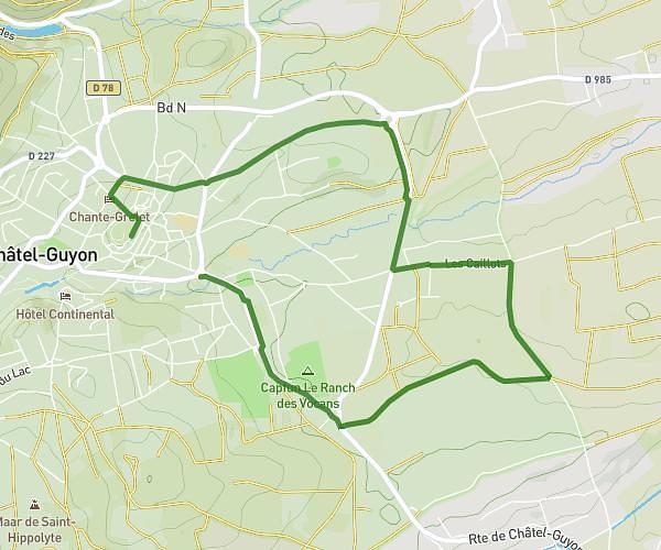
This running route covers 9.562mi starting from Châtel-Guyon, Puy-de-Dôme. The run is a loop trail and returns to the trailhead. This run is rated as hard, expect about 1h30m to complete it. The route has an elevation gain of 558ft and an elevation loss of 561ft.
16 km
Route details
6.38mph
Speed
1029 kcal
Calories burned
Loop trail
Route type
1148ft
Min altitude
1480ft
Max altitude
Route profile
558ft
Elevation gain
561ft
Elevation loss
1148ft
Min altitude
1480ft
Max altitude
How to get there
Trailhead: Rue Alfred Punett, 63140 Châtel-Guyon
GPS coordinates of the trailhead: 45.91869, 3.06397 / 45°55'7'' N, 3°3'50'' E