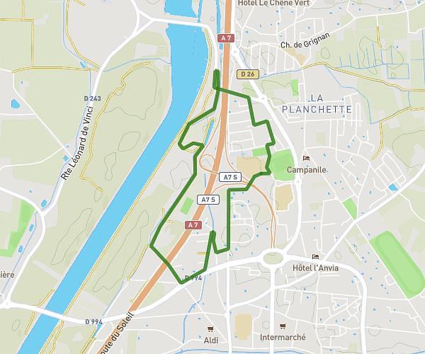
This running route covers 6.754mi starting from Valréas, Vaucluse. The run is a loop trail and returns to the trailhead. This run is rated as moderate, expect about 1h12m to complete it. The route has an elevation gain of 308ft and an elevation loss of 312ft.
Vacances 1
Route details
5.63mph
Speed
823 kcal
Calories burned
Loop trail
Route type
761ft
Min altitude
853ft
Max altitude
Route profile
308ft
Elevation gain
312ft
Elevation loss
761ft
Min altitude
853ft
Max altitude
How to get there
Trailhead: 3 Cours Du Berteuil, 84600 Valréas, France
GPS coordinates of the trailhead: 44.38409, 4.99338 / 44°23'2'' N, 4°59'36'' E