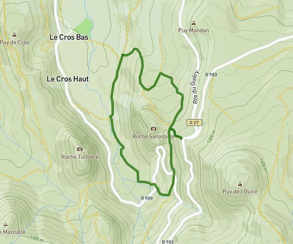
This walking route covers 2.684mi starting from Murat-le-Quaire, Puy-de-Dôme. The walk is a loop trail and returns to the trailhead. This walk is rated as easy, plan for about 1h26m to complete it. The route has an elevation gain of 518ft and an elevation loss of 515ft.
Banne d'Ordanche
Route details
32:11/mi
Pace
353 kcal
Calories burned
Loop trail
Route type
4301ft
Min altitude
4797ft
Max altitude
Route profile
518ft
Elevation gain
515ft
Elevation loss
4301ft
Min altitude
4797ft
Max altitude
How to get there
Trailhead: 6365 Route De La Banne D'ordanche, 63150 Murat-le-Quaire, France
GPS coordinates of the trailhead: 45.617604, 2.768408 / 45°37'3'' N, 2°46'6'' E