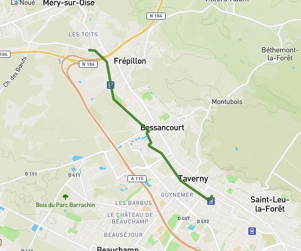
This running route covers 10.606mi starting from Le Mesnil-en-Thelle, Oise. The run does not return to the trailhead and ends near 21 7e Avenue, 60260 Lamorlaye, France. This run is rated as hard, expect about 1h42m to complete it. The route has an elevation gain of 16ft and an elevation loss of 56ft.
Mesnil Lamorlaye
Route details
6.24mph
Speed
1166 kcal
Calories burned
Point to point
Route type
102ft
Min altitude
151ft
Max altitude
Route profile
16ft
Elevation gain
56ft
Elevation loss
102ft
Min altitude
151ft
Max altitude
How to get there
Trailhead: 17 Rue Marcel Dassault, 60530 Le Mesnil-en-Thelle, France
GPS coordinates of the trailhead: 49.17877, 2.28352 / 49°10'43'' N, 2°17'0'' E