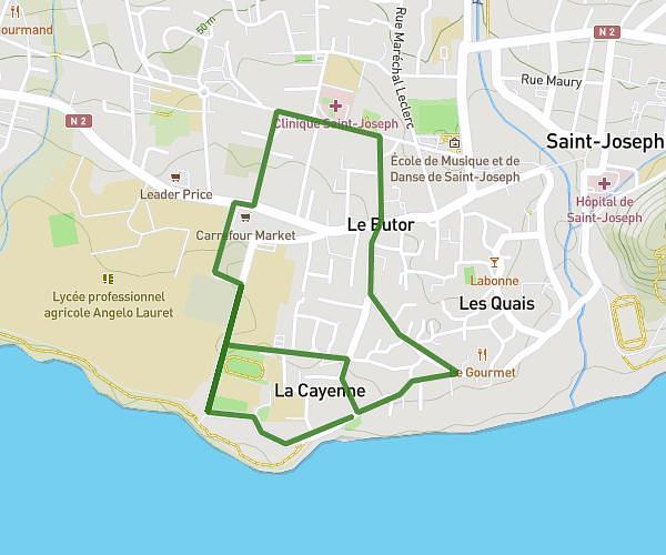
This running route covers 4.977mi starting from Saint-Pierre, Reunion. The run is a loop trail and returns to the trailhead. This run is rated as moderate, expect about 51m to complete it. The route has an elevation gain of 705ft and an elevation loss of 699ft.
Run
Route details
5.85mph
Speed
583 kcal
Calories burned
Loop trail
Route type
1329ft
Min altitude
1736ft
Max altitude
Route profile
705ft
Elevation gain
699ft
Elevation loss
1329ft
Min altitude
1736ft
Max altitude
How to get there
Trailhead: 9 Chemin Corbeille D'or, 97410, Saint-Pierre, Reunion
GPS coordinates of the trailhead: -21.289464, 55.510799 / 21°17'22'' S, 55°30'38'' E