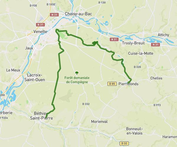
This hiking trail covers 21.323mi starting from Pierrefonds, Oise. The hike does not return to the trailhead and ends near Rue Royale, 60138 Chiry-Ourscamp. This hike is rated as hard, plan for about 6h2m to complete it. The route has an elevation gain of 719ft and an elevation loss of 850ft.
ÉTAPE 4 (ENSEMBLE CONTRE CHARCOT)
Route details
3.54mph
Speed
2561 kcal
Calories burned
1.4%
Avg grade
Point to point
Route type
105ft
Min altitude
449ft
Max altitude
Route profile
719ft
Elevation gain
850ft
Elevation loss
105ft
Min altitude
449ft
Max altitude
How to get there
Trailhead: Rue Louis D'orléans, 60350 Pierrefonds
GPS coordinates of the trailhead: 49.34766, 2.97778 / 49°20'51'' N, 2°58'40'' E