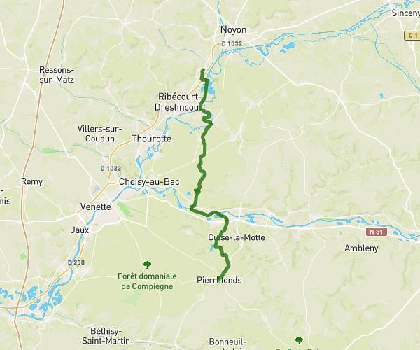
This hiking trail covers 23.685mi starting from Béthisy-Saint-Pierre, Oise. The hike does not return to the trailhead and ends near Rue Jules Michelet, 60350 Pierrefonds. This hike is rated as hard, plan for about 8h15m to complete it. The route has an elevation gain of 1014ft and an elevation loss of 965ft.
ÉTAPE 3 (ENSEMBLE CONTRE CHARCOT)
Route details
2.87mph
Speed
3512 kcal
Calories burned
1.6%
Avg grade
Point to point
Route type
141ft
Min altitude
456ft
Max altitude
Route profile
1014ft
Elevation gain
965ft
Elevation loss
141ft
Min altitude
456ft
Max altitude
How to get there
Trailhead: Rue Esmery, 60320 Béthisy-Saint-Pierre
GPS coordinates of the trailhead: 49.30298, 2.81197 / 49°18'10'' N, 2°48'43'' E