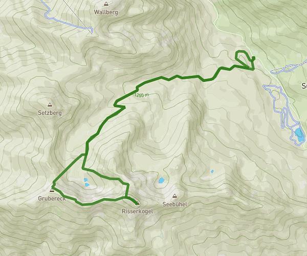
This hiking trail covers 5.328mi starting from Schliersee, Bavaria. The hike does not return to the trailhead and ends near E 2 2, 83700 Rottach-Egern, Germany. This hike is rated as strenuous, plan for about 2h47m to complete it. The route has an elevation gain of 1394ft and an elevation loss of 2382ft.
Hütte 2026 Vorschlag 1
Route details
1.91mph
Speed
1266 kcal
Calories burned
13.4%
Avg grade
Point to point
Route type
2615ft
Min altitude
4852ft
Max altitude
Steep climb
Route profile
1394ft
Elevation gain
2382ft
Elevation loss
2615ft
Min altitude
4852ft
Max altitude
How to get there
Trailhead: Lyraweg 8, 83727 Schliersee, Germany
GPS coordinates of the trailhead: 47.661393, 11.880686 / 47°39'41'' N, 11°52'50'' E