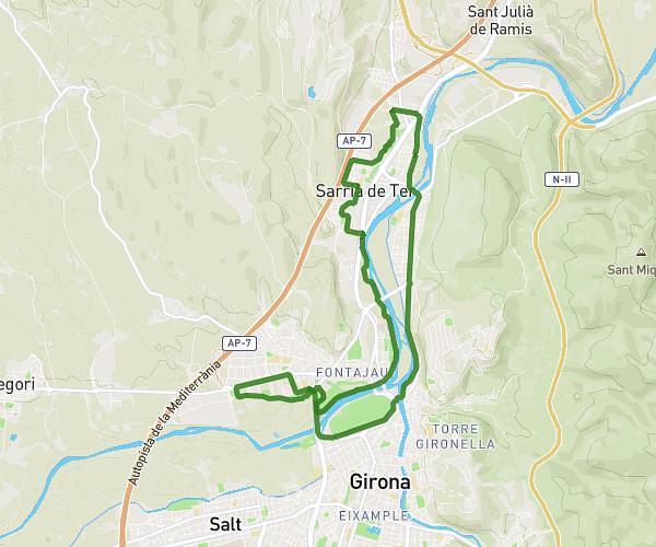
This running route covers 10.808mi starting from Sarrià de Ter, Girona. The run does not return to the trailhead and ends near Avinguda De França, 17840 Sarrià de Ter. This run is rated as hard, expect about 1h48m to complete it. The route has an elevation gain of 404ft and an elevation loss of 446ft.
17k
Route details
6.0mph
Speed
1235 kcal
Calories burned
Point to point
Route type
190ft
Min altitude
289ft
Max altitude
Route profile
404ft
Elevation gain
446ft
Elevation loss
190ft
Min altitude
289ft
Max altitude
How to get there
Trailhead: Passeig De Federico García Lorca, 17840 Sarrià de Ter
GPS coordinates of the trailhead: 42.01489, 2.81559 / 42°0'53'' N, 2°48'56'' E