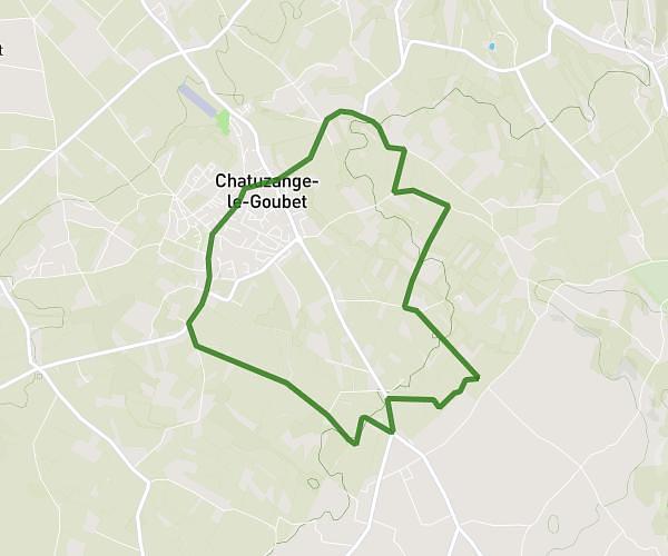
This running route covers 1.892mi starting from Tain-l'Hermitage, Drôme. The run is a loop trail and returns to the trailhead. This run is rated as easy, expect about 20m to complete it. The route has an elevation gain of 79ft and an elevation loss of 75ft.
3Kil - Viarhona
Route details
5.68mph
Speed
229 kcal
Calories burned
Loop trail
Route type
377ft
Min altitude
397ft
Max altitude
Route profile
79ft
Elevation gain
75ft
Elevation loss
377ft
Min altitude
397ft
Max altitude
How to get there
Trailhead: 2 Chemin Des Lucs, 26600 Tain-l'Hermitage, France
GPS coordinates of the trailhead: 45.066258, 4.850994 / 45°3'58'' N, 4°51'3'' E