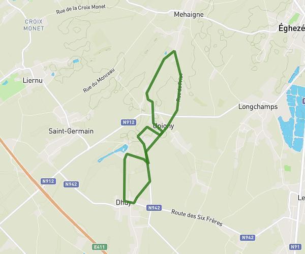
This running route covers 3.321mi starting from Châtelet, Hainaut. The run is a loop trail and returns to the trailhead. This run is rated as easy, expect about 35m37s to complete it. The route has an elevation gain of 233ft and an elevation loss of 233ft.
2ème année
Route details
5.59mph
Speed
407 kcal
Calories burned
Loop trail
Route type
387ft
Min altitude
558ft
Max altitude
Route profile
233ft
Elevation gain
233ft
Elevation loss
387ft
Min altitude
558ft
Max altitude
How to get there
Trailhead: Rue Olivier Gilles 92, 6200 Châtelet, Hainaut, Belgium
GPS coordinates of the trailhead: 50.40121, 4.53369 / 50°24'4'' N, 4°32'1'' E