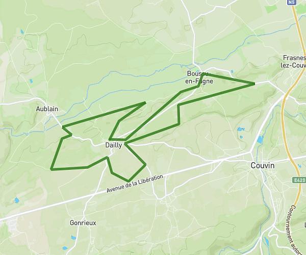
This running route covers 7.978mi starting from Florennes, Namur. The run is a loop trail and returns to the trailhead. This run is rated as hard, expect about 2h20m to complete it. The route has an elevation gain of 299ft and an elevation loss of 217ft.
4ème année
Route details
3.42mph
Speed
1601 kcal
Calories burned
Loop trail
Route type
594ft
Min altitude
889ft
Max altitude
Route profile
299ft
Elevation gain
217ft
Elevation loss
594ft
Min altitude
889ft
Max altitude
How to get there
Trailhead: Rue De La Forge 129, 5621 Florennes, Namur, Belgium
GPS coordinates of the trailhead: 50.28967, 4.5172 / 50°17'22'' N, 4°31'1'' E