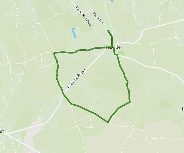
This hiking trail covers 4.041mi starting from Malaunay, Seine-Maritime. The hike does not return to the trailhead and ends near 14 Rue Des Martyrs De La Résistance, 76770 Malaunay, France. This hike is rated as easy, plan for about 1h27m to complete it. The route has an elevation gain of 279ft and an elevation loss of 443ft.
parcour
Route details
2.78mph
Speed
622 kcal
Calories burned
3.4%
Avg grade
Point to point
Route type
102ft
Min altitude
292ft
Max altitude
Route profile
279ft
Elevation gain
443ft
Elevation loss
102ft
Min altitude
292ft
Max altitude
How to get there
Trailhead: 20 Rue René Cassin, 76770 Malaunay, France
GPS coordinates of the trailhead: 49.526668, 1.028373 / 49°31'36'' N, 1°1'42'' E