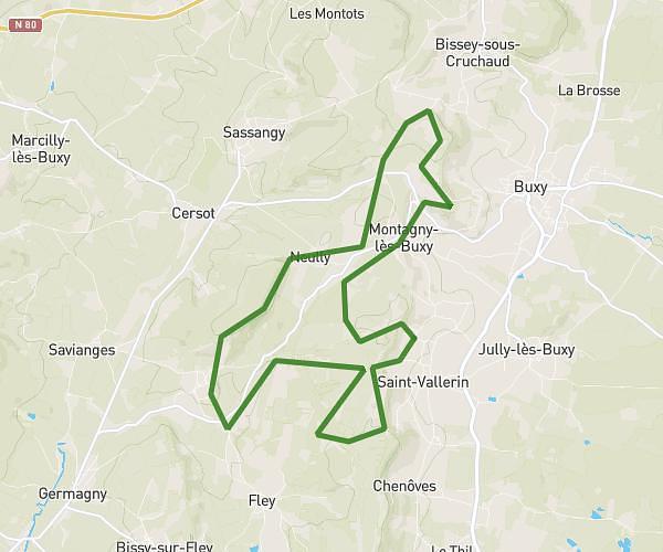
This running route covers 3.669mi starting from Couches, Saône-et-Loire. The run is a loop trail and returns to the trailhead. This run is rated as easy, expect about 44m to complete it. The route has an elevation gain of 679ft and an elevation loss of 692ft.
Footing SCC
Route details
5.0mph
Speed
503 kcal
Calories burned
Loop trail
Route type
978ft
Min altitude
1358ft
Max altitude
Route profile
679ft
Elevation gain
692ft
Elevation loss
978ft
Min altitude
1358ft
Max altitude
How to get there
Trailhead: 2 Rue De L'arquebuse, 71490 Couches, France
GPS coordinates of the trailhead: 46.86779, 4.57375 / 46°52'4'' N, 4°34'25'' E