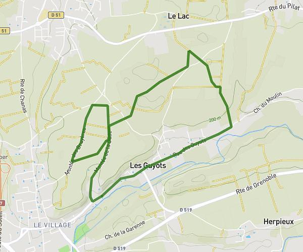
This running route covers 16.085mi starting from Saint-Jeure-d'Ay, Ardèche. The run is a loop trail and returns to the trailhead. This run is rated as strenuous, expect about 2h53m to complete it. The route has an elevation gain of 2159ft and an elevation loss of 2159ft.
Buisson
Route details
5.58mph
Speed
1978 kcal
Calories burned
Loop trail
Route type
1539ft
Min altitude
2651ft
Max altitude
Route profile
2159ft
Elevation gain
2159ft
Elevation loss
1539ft
Min altitude
2651ft
Max altitude
How to get there
Trailhead: 615 Route De Zipon, 07290 Saint-Jeure-d'Ay, France
GPS coordinates of the trailhead: 45.142548, 4.698929 / 45°8'33'' N, 4°41'56'' E