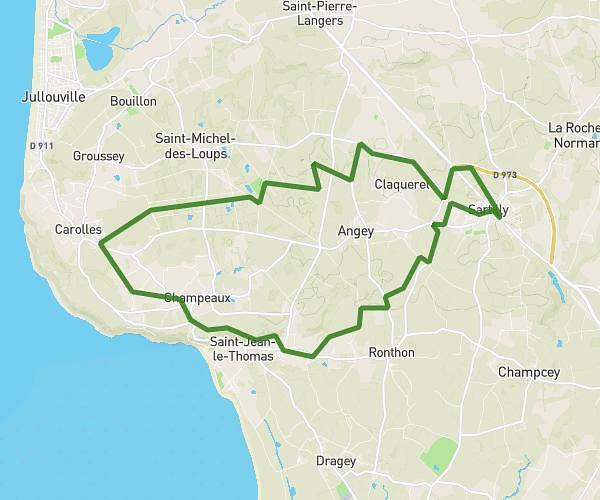
This running route covers 9.911mi starting from Granville, Manche. The run does not return to the trailhead and ends near 5b Avenue Maréchal Leclerc, 50530 Saint-Jean-le-Thomas, France. This run is rated as hard, expect about 1h19m to complete it. The route has an elevation gain of 177ft and an elevation loss of 262ft.
Granville - St Jean le Thomas
Route details
7.46mph
Speed
912 kcal
Calories burned
Point to point
Route type
33ft
Min altitude
210ft
Max altitude
Route profile
177ft
Elevation gain
262ft
Elevation loss
33ft
Min altitude
210ft
Max altitude
How to get there
Trailhead: 54 Rue Jean Rostand, 50400 Granville, France
GPS coordinates of the trailhead: 48.832053, -1.57097 / 48°49'55'' N, 1°34'15'' W