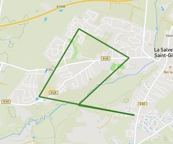
This walking route covers 6.033mi starting from Samatan, Gers. The walk is a loop trail and returns to the trailhead. This walk is rated as hard, plan for about 1h37m to complete it. The route has an elevation gain of 472ft and an elevation loss of 472ft.
02/03/2024
Route details
16:06/mi
Pace
396 kcal
Calories burned
Loop trail
Route type
548ft
Min altitude
830ft
Max altitude
Route profile
472ft
Elevation gain
472ft
Elevation loss
548ft
Min altitude
830ft
Max altitude
How to get there
Trailhead: Impasse Des Chênes, 32130 Samatan
GPS coordinates of the trailhead: 43.49185, 0.92497 / 43°29'30'' N, 0°55'29'' E