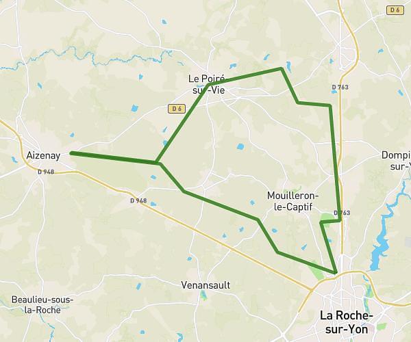
This hiking trail covers 6.621mi starting from Mouilleron-le-Captif, Vendée. The hike is a loop trail and returns to the trailhead. This hike is rated as easy, plan for about 2h15m to complete it. The route has an elevation gain of 305ft and an elevation loss of 308ft.
BEAUPUY
Route details
2.95mph
Speed
959 kcal
Calories burned
1.8%
Avg grade
Loop trail
Route type
200ft
Min altitude
269ft
Max altitude
Route profile
305ft
Elevation gain
308ft
Elevation loss
200ft
Min altitude
269ft
Max altitude
How to get there
Trailhead: 30 Rue Du Château De Beaupuy, 85000 Mouilleron-le-Captif, France
GPS coordinates of the trailhead: 46.712853, -1.436935 / 46°42'46'' N, 1°26'12'' W