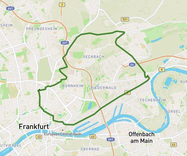
This cycling route covers 11.965mi starting from Frankfurt am Main, Hesse. The ride is a loop trail and returns to the trailhead. This route is rated as easy, plan for about 1h12m to complete it. The route has an elevation gain of 236ft and an elevation loss of 256ft.
Temperatur 34 Grad
Route details
633 kcal
Calories burned
0.8%
Avg grade
Loop trail
Route type
328ft
Min altitude
584ft
Max altitude
Route profile
236ft
Elevation gain
256ft
Elevation loss
328ft
Min altitude
584ft
Max altitude
How to get there
Trailhead: Schwarzburgstraße 49, 60318 Frankfurt am Main, Germany
GPS coordinates of the trailhead: 50.1276, 8.6865 / 50°7'39'' N, 8°41'11'' E