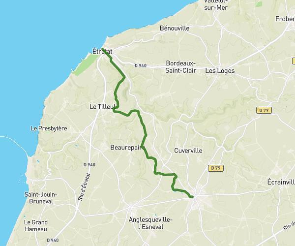
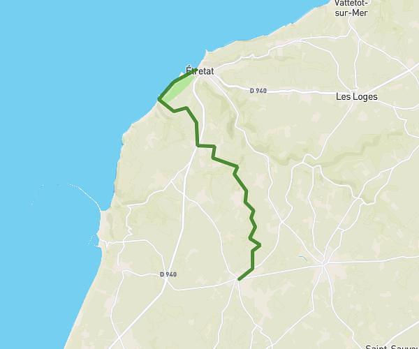
This hiking trail covers 7.323mi starting from Criquetot-l'Esneval, Seine-Maritime. The hike does not return to the trailhead and ends near 4 Boulevard Président René Coty, 76790 Étretat, France. This hike is rated as moderate, plan for about 2h35m to complete it. The route has an elevation gain of 499ft and an elevation loss of 869ft.
anais
Route details
2.83mph
Speed
1108 kcal
Calories burned
3.5%
Avg grade
Point to point
Route type
20ft
Min altitude
430ft
Max altitude
Route profile
499ft
Elevation gain
869ft
Elevation loss
20ft
Min altitude
430ft
Max altitude
How to get there
Trailhead: 17 Rue Des Prés, 76280 Criquetot-l'Esneval, France
GPS coordinates of the trailhead: 49.643935, 0.264204 / 49°38'38'' N, 0°15'51'' E