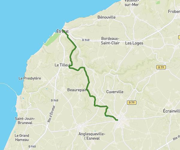
This hiking trail covers 7.687mi starting from Gonneville-la-Mallet, Seine-Maritime. The hike does not return to the trailhead and ends near Terrasse Monet, 76790 Étretat, France. This hike is rated as moderate, plan for about 2h34m to complete it. The route has an elevation gain of 561ft and an elevation loss of 974ft.
Gonneville la mallet - Etretat
Route details
3.0mph
Speed
1103 kcal
Calories burned
3.8%
Avg grade
Point to point
Route type
13ft
Min altitude
427ft
Max altitude
Route profile
561ft
Elevation gain
974ft
Elevation loss
13ft
Min altitude
427ft
Max altitude
How to get there
Trailhead: 2 Rue Léon Duboc, 76280 Gonneville-la-Mallet, France
GPS coordinates of the trailhead: 49.63908, 0.223227 / 49°38'20'' N, 0°13'23'' E