MapPlanner
3.319mi
Distance
20m
Duration
9.95mph
Speed
+174ft
Elevation gain
-174ft
Elevation loss
Easy
Level

BDS SPORTS CLUB - run, mix & brunch

Route details

177 kcal
Calories burned
2.0%
Avg grade
Loop trail
Route type
72ft
Min altitude
105ft
Max altitude

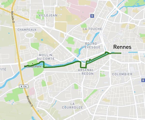
This cycling route covers 3.319mi starting from Rennes, Ille-et-Vilaine. The ride is a loop trail and returns to the trailhead. This route is rated as easy, plan for about 20m to complete it. The route has an elevation gain of 174ft and an elevation loss of 174ft.

Route profile

174ft
Elevation gain
174ft
Elevation loss
72ft
Min altitude
105ft
Max altitude

How to get there

Trailhead: 2 Quai Saint-Cyr, 35000 Rennes, France

GPS coordinates of the trailhead: 48.109746, -1.685966 / 48°6'35'' N, 1°41'9'' W

Caution: May Cross Private Property

This route may pass through or near private property. Always respect posted signs, obtain permission where required, and follow local trespassing laws. MapPlanner does not guarantee public access along any route.

Safety Notice

Trail and road conditions may change without notice due to weather, construction, or other factors. Always verify current conditions before heading out. You are responsible for your own safety — follow local signage, obey traffic laws, and use your best judgment on the trail.