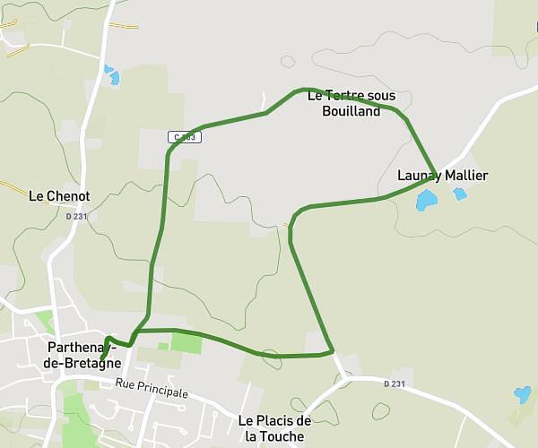
This cycling route covers 15.253mi starting from La Chapelle-Bouëxic, Ille-et-Vilaine. The ride is a loop trail and returns to the trailhead. This route is rated as moderate, plan for about 1h32m to complete it. The route has an elevation gain of 180ft and an elevation loss of 184ft.
LE PONT DE CANUT
Route details
807 kcal
Calories burned
0.5%
Avg grade
Loop trail
Route type
154ft
Min altitude
236ft
Max altitude
Route profile
180ft
Elevation gain
184ft
Elevation loss
154ft
Min altitude
236ft
Max altitude
How to get there
Trailhead: 10 La Moinerie, 35330 La Chapelle-Bouëxic, France
GPS coordinates of the trailhead: 47.94109, -1.89967 / 47°56'27'' N, 1°53'58'' W