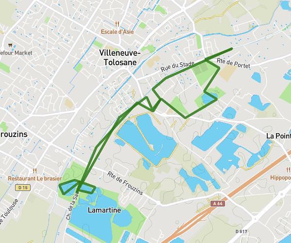
This running route covers 6.214mi starting from Toulouse, Haute-Garonne. The run does not return to the trailhead and ends near 2 Rue Alex Coutet, 31100 Toulouse, France. This run is rated as moderate, expect about 54m32s to complete it. The route has an elevation gain of 20ft and an elevation loss of 26ft.
10K
Route details
6.84mph
Speed
623 kcal
Calories burned
Point to point
Route type
499ft
Min altitude
518ft
Max altitude
Route profile
20ft
Elevation gain
26ft
Elevation loss
499ft
Min altitude
518ft
Max altitude
How to get there
Trailhead: 44 Rue Alex Coutet, 31100 Toulouse, France
GPS coordinates of the trailhead: 43.576625, 1.389489 / 43°34'35'' N, 1°23'22'' E