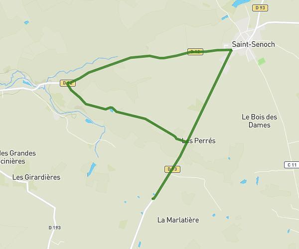
This running route covers 4.337mi starting from Betz-le-Château, Indre-et-Loire. The run does not return to the trailhead and ends near D 93, 37600 Betz-le-Château, France. This run is rated as easy, expect about 1h to complete it. The route has an elevation gain of 0ft and an elevation loss of 43ft.
Les loges
Route details
4.34mph
Speed
686 kcal
Calories burned
Point to point
Route type
413ft
Min altitude
456ft
Max altitude
Route profile
0ft
Elevation gain
43ft
Elevation loss
413ft
Min altitude
456ft
Max altitude
How to get there
Trailhead: 3110 Les Loges, 37600 Betz-le-Château, France
GPS coordinates of the trailhead: 46.99956, 0.99781 / 46°59'58'' N, 0°59'52'' E