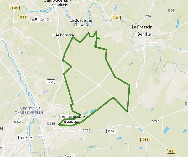
This running route covers 6.571mi starting from Beaulieu-lès-Loches, Indre-et-Loire. The run is a loop trail and returns to the trailhead. This run is rated as moderate, expect about 1h to complete it. The route has an elevation gain of 453ft and an elevation loss of 453ft.
10,57km Beaulieu
Route details
6.57mph
Speed
686 kcal
Calories burned
Loop trail
Route type
233ft
Min altitude
446ft
Max altitude
Route profile
453ft
Elevation gain
453ft
Elevation loss
233ft
Min altitude
446ft
Max altitude
How to get there
Trailhead: 6 Rue Georges Patry, 37600 Beaulieu-lès-Loches, France
GPS coordinates of the trailhead: 47.12742, 1.013 / 47°7'38'' N, 1°0'46'' E